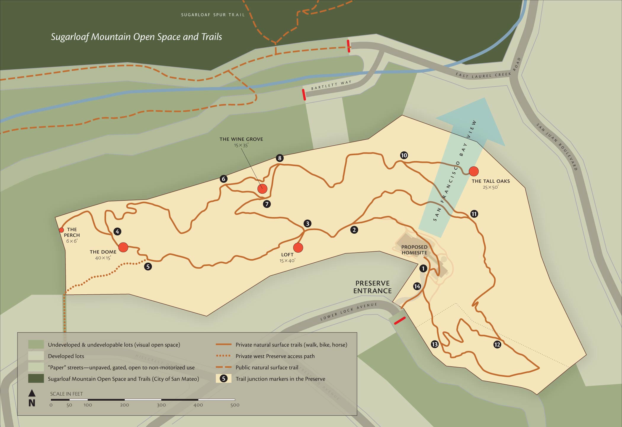
Much of the Preserve borders on undeveloped lots (darker green) which cannot be developed under current City of Belmont laws. These lands serve as de facto open space, extending the visual and ecological boundaries of the Preserve. Where developed lots border the Preserve, native and mature vegetation and trail alignments screen most manmade structures from view.
Multiple loop and spur trails within the Preserve playfully explore most interesting areas and the best viewpoints. Starting from the house, you can make one big loop or a number of shorter loops. With mostly gentle grades traversing the canyon wall, the smooth trails pass through oak savannas, a buckeye grove, lovely ground covers and even a patch of sagebrush with a view of the Bay. They’re excellent for strolling, hiking and mountain biking. You could ride a horse, too.
Terraces at key points create level areas for picnics, play or enjoying the day. The Wine Grove is a particularly pleasant spot. With a wide view of Sugarloaf Mountain and no manmade structures, it’s a splendid spot for wine after dinner while enjoying the sun setting on Sugarloaf’s broad flank. Some oaks would be wonderful for swings and tree houses for both kids and adults.
 Another view of the Preserve. The red area indicates the footprint of the exterior walls of the proposed house. Image © 2020 Google, made with Google Earth. Image Landsat/Copernicus. Imagery date: August 9, 2018.